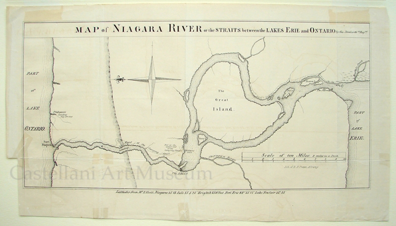
Map of Niagara River or the Straits between the Lakes Erie and Ontario by Geo. Demler 60th Reg'mt, 1849
Richard H. Pease —- American
- 1813-1891
This lithograph map was recreated from a 1760 map by British military cartographer George Demler. It was reproduced for the 1849 printing of E.B. O'Callaghan's The Documentary History of the State of New York, Albany: Weed, Parsons & Co. Richard H. The creator of the 1949 version, Richard H. Pease, was a printer and proprietor of the Pease Great Variety Store, located in the still-standing location at 518 Broadway in Albany, NY. Pease is credited with creating the first-ever Christmas card produced in the United States in 1842.